
Ever noticed that little public right of way that drops down a flight of steps off Herries Road just below the famous Five Arches railway viaduct?
It forms part of the proposed Upper Don Trail route, and is currently a walking route in need of some upgrading running alongside Toad Hole Dyke and through Rawson Spring Wood to the River Don alongside Wardsend Cemetery.
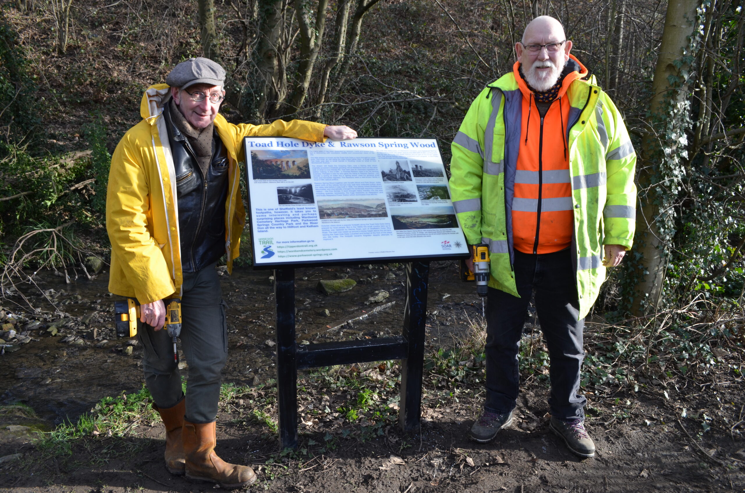
We’ve now put up a shiny new information board to tell you more about this little-known area and its fascinating history.
Did you know, for example, that the name Toad Hole Dyke is thought to come from “Tod Hole”? Tod being an old name for a male fox rather than a small amphibian. Tod Hole was also a small hamlet in Southey close to what is now Wordsworth Avenue.
We’re hoping the information board will entice more people to explore the path, which forms part of our long-term plan to improve links to the River Don from the Herries Road area as part of the overall Upper Don Trail.
The path will also help to connect north Sheffield communities to the new Parkwood Springs Country Park that’s now being funded by government Levelling Up money including we hope upgrading of the trail as an important gateway.
The photograph shows Upper Don Trail trustees Simon Ogden and Tony Canning with their cordless drills after attaching the new sign to its mounting stand.
We’d like to thank the SOAR community regeneration charity, based in north Sheffield, for their generous grant funding and volunteer support.
This meant we were able to replace a temporary sign that we’d put up to replace a long-since vandalised board dating back to the 1980s.
SOAR’s support also enabled us to build a new flight of steps next to the Toad Hole Dyke footbridge. And it made possible a series of volunteer work days with Wardsend Cemetery supporters and the Trust for Conservation Volunteers to cut back overgrowth and generally tidy the path up.
The board represents the first initiative of what we hope will become a more comprehensive waymarking project for the whole 23 km Upper Don Trail route over the next two to three years, working with a range of partners.
If you live near the Five Arches, we’d love you to explore the path and let us know what you think. We hope the information board will tell you a bit more about it and add to your experience.
Leave a Reply
You must be logged in to post a comment.